Ecorse River
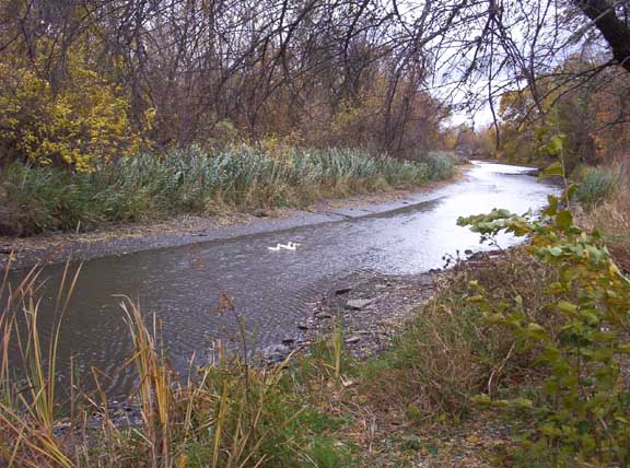
The North Branch of the Ecorse River at Council Point Park in Lincoln Park. Photo: Rmhermen via Wikimedia Commons (CC BY-SA 3.0).
The Ecorse River — often called Ecorse Creek for its small size — is an 18.8-mile river in the Downriver suburbs of Metro Detroit and a tributary of the Detroit River. Its name comes from the early French Rivière aux Écorces (“bark river”), for the Native American custom of wrapping the dead in birch or elm bark and burying them at the river’s mouth.
The river has two branches that meet at Council Point Park in Lincoln Park — the historic site where Chief Pontiac held a council in 1763 before attacking Fort Detroit. The North Branch runs about 18.2 miles, the South Branch about 4.5 miles (10.7 miles including the Sexton-Kilfoil Drain), and the combined river flows roughly 0.6 mile to the Detroit River.
Here is the honest part: this is not yet a paddling destination. Mean flow is around 3.2 cubic feet per second — a trickle by kayaking standards — and recent planning work notes that safe canoe/kayak launch infrastructure still needs to be created. The lower creek is described as calm, but there is no established water trail. Treat the Ecorse as a place to watch, advocate for, and explore on foot — not as a river to assume is navigable.
At a Glance
- Approximate length: 18.8 miles total (branches plus the 0.6-mile combined reach)
- Difficulty: Not established for paddling
- Water character: Very small, low-flow urban stream (about 3.2 cfs mean flow)
- Best season: Not established — only after rains would there be enough water, and conditions are unverified
Paddling Sections
No established paddling sections. We won’t describe a route that doesn’t responsibly exist yet. If public access is developed around Council Point Park or the lower creek in the future, we’ll update this guide.
Hazards & Portages
- Low water: At roughly 3.2 cfs mean flow, much of the system is likely too shallow to float a kayak for most of the year.
- Urban water quality: Downriver streams carry stormwater runoff. Avoid the water after heavy rains and don’t submerge your head.
- Dams, culverts, and debris: Unverified — scout from shore before even considering any section.
Access & Parking
Council Point Park, Lincoln Park (3949 River Dr): The historic confluence of the two branches and the natural reference point for the river — but not a launch. There is currently no developed kayak launch on the Ecorse River; recent planning identified launch infrastructure as still to be created.
Map
The pin marks Council Point Park in Lincoln Park, where the river’s two branches meet — a historic reference point, not a launch.
Paddle It With the Club
Urban water trails start with paddlers who show up and advocate. Join the West Michigan Kayaking Club to connect with the people working to open up rivers like the Ecorse — and to paddle the many Michigan rivers that are ready today.
Michigan’s Lower Peninsula River Guide • Join the West Michigan Kayaking Club on Facebook