Michigan's Lower Peninsula River Guide
Wild Rivers. Rugged Trails. Real Adventure.

Au Gres River
Ogemaw County
Quiet, wooded river to Saginaw Bay at Au Gres.
Camping: See the guide for camping info
View guide →
Au Sable River
Michigan's legendary canoe country.
Camping: Available — details in the guide
View guide →
Bad River (Saginaw County)
Saginaw County
Saginaw Valley river from St. Charles to the Shiawassee River.
Camping: Available — details in the guide
View guide →
Baldwin River
Lake County
Brushy Pere Marquette River tributary in Lake County.
Camping: See the guide for camping info
View guide →
Bass River
Ottawa County
Short Ottawa County tributary to the Grand River.
Camping: Available — details in the guide
View guide →
Battle Creek River
Calhoun County
Bellevue to Battle Creek on a Kalamazoo River tributary.
Camping: Available — details in the guide
View guide →
Bear River (Petoskey)
Petoskey river with a whitewater park run to Little Traverse Bay.
Camping: See the guide for camping info
View guide →
Belle River
Lapeer County
Blue Water river from Imlay City and Memphis to the St. Clair River.
Camping: See the guide for camping info
View guide →
Betsie River
Benzie County
National Wild and Scenic gem.
Camping: See the guide for camping info
View guide →
Big Sable River
Lake County
Shoreline river flowing into Hamlin Lake.
Camping: See the guide for camping info
View guide →
Black River (Alcona County)
Alcona County
About 15.5 miles to Lake Huron at the village of Black River.
Camping: Available — details in the guide
View guide →
Black River (Cheboygan County)
Cheboygan County
Fast, wild brook-trout river flowing north to Black Lake.
Camping: Available — details in the guide
View guide →
Black River (Port Huron)
Sanilac County
Thumb river of about 81 miles, wild in the Port Huron State Game Area.
Camping: See the guide for camping info
View guide →
Black River (South Haven)
Allegan County
Dark-water river reaching Lake Michigan at South Haven.
Camping: See the guide for camping info
View guide →
Boardman River
Kalkaska County
Traverse City's backyard river.
Camping: Available — details in the guide
View guide →
Boyne River
Otsego County
Lake Charlevoix tributary named for Ireland's River Boyne.
Camping: See the guide for camping info
View guide →
Carp Lake River
Emmet County
Lake Paradise outlet running to Lake Michigan near the Straits.
Camping: See the guide for camping info
View guide →
Cass River
Thumb water trail through Vassar and Frankenmuth.
Camping: See the guide for camping info
View guide →
Cedar River (Gladwin/Clare)
Clare County
Cedar-bank river from Clare County to the Tobacco River at Beaverton.
Camping: See the guide for camping info
View guide →
Cheboygan River
Final link of the Inland Waterway, Mullett Lake to Lake Huron.
Camping: See the guide for camping info
View guide →
Chippewa River
Isabella County
Wooded river through Isabella County, Barryton to Midland.
Camping: See the guide for camping info
View guide →
Clam River
Missaukee County
Cadillac river from Lake Cadillac to the Muskegon River.
Camping: Available — details in the guide
View guide →
Clinton River
Oakland County
Metro Detroit river from Oakland County to Lake St. Clair.
Camping: Available — details in the guide
View guide →
Coldwater River
Barry County
Spring-fed trout stream to the Thornapple River.
Camping: See the guide for camping info
View guide →
Coldwater River (Branch)
Branch County
About 29.5 miles through the Coldwater lake country to Union City.
Camping: Available — details in the guide
View guide →
Crooked River
Emmet County
Inland Waterway channel linking Crooked Lake to Burt Lake.
Camping: See the guide for camping info
View guide →
Crystal River
Leelanau spring creek, Glen Lake to Glen Arbor.
Camping: See the guide for camping info
View guide →
Detroit River
Border river from Lake St. Clair to Lake Erie at Detroit.
Camping: Available — details in the guide
View guide →
Dowagiac River
Van Buren County
Tree-lined river flowing to the St. Joseph near Niles.
Camping: See the guide for camping info
View guide →
Ecorse River
Downriver tributary joining at Council Point Park in Lincoln Park.
Camping: See the guide for camping info
View guide →
Elk River
Antrim County
Elk Lake's short outlet river at Elk Rapids.
Camping: See the guide for camping info
View guide →
Fawn River
Small, twisty river from Indiana to Constantine.
Camping: Available — details in the guide
View guide →
Flat River
Kent County
Gentle West Michigan paddling.
Camping: Available — details in the guide
View guide →
Flint River
Lapeer County
Historic auto-city river through Flint and Genesee County.
Camping: See the guide for camping info
View guide →
Galien River
Berrien County
Berrien County river flowing to Lake Michigan at New Buffalo.
Camping: See the guide for camping info
View guide →
Grand River
Hillsdale County
Michigan's longest river.
Camping: Available — details in the guide
View guide →
Grass River
Antrim County
Short Chain of Lakes link between Lake Bellaire and Clam Lake.
Camping: See the guide for camping info
View guide →
Gun River
Allegan County
Gun Lake outlet running to the Kalamazoo River east of Otsego.
Camping: See the guide for camping info
View guide →
Hersey River
Osceola County
Osceola County river through Reed City to the Muskegon at Hersey.
Camping: Available — details in the guide
View guide →
Huron River
Oakland County
Southeast Michigan's paddling corridor.
Camping: See the guide for camping info
View guide →
Indian River
Cheboygan County
Burt-to-Mullett connector at the heart of the Inland Waterway.
Camping: See the guide for camping info
View guide →
Intermediate River
Antrim County
Antrim County headwater of the Elk River Chain of Lakes.
Camping: See the guide for camping info
View guide →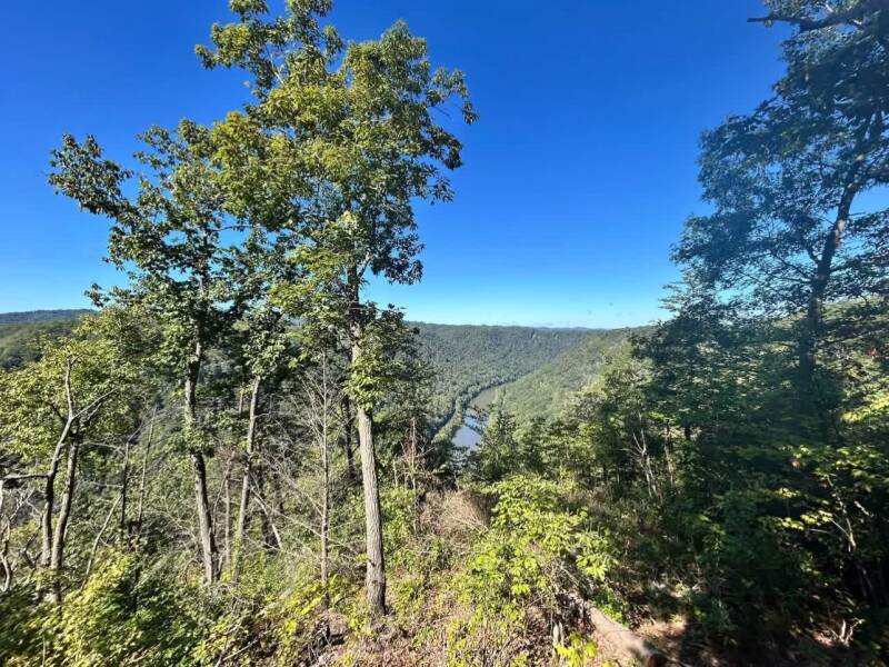
Jordan River
Antrim County
Michigan's first Natural River.
Camping: Available — details in the guide
View guide →
Kalamazoo River
Hillsdale County
Southwest Michigan's working river.
Camping: See the guide for camping info
View guide →
Kawkawlin River
Bay County
“Place of pike” river joining northwest of Bay City.
Camping: See the guide for camping info
View guide →
Leland River
Lake Leelanau outlet to Lake Michigan at Leland.
Camping: See the guide for camping info
View guide →
Lincoln River
Mason County
Branch river through Lincoln Lake to Lake Michigan near Ludington.
Camping: See the guide for camping info
View guide →
Little Manistee River
Mason County
Cold, wooded trout stream in the northwest Lower Peninsula.
Camping: See the guide for camping info
View guide →
Little Muskegon River
Quiet forest river from Morley to Croton Pond.
Camping: Available — details in the guide
View guide →
Looking Glass River
Clinton County
Slow, dam-free river through Clinton County to Portland.
Camping: See the guide for camping info
View guide →
Macatawa River
Ottawa County
“Black water” river through Holland, also called the Black River.
Camping: See the guide for camping info
View guide →
Manistee River
Manistee County
About 190 miles of classic northern Michigan paddling.
Camping: Available — details in the guide
View guide →
Maple River
Emmet County
Marsh-lined river through the Maple River State Game Area to Muir.
Camping: See the guide for camping info
View guide →
Maple River (Emmet County)
Emmet County
Pellston and Douglas Lake branches, once dammed at Lake Kathleen.
Camping: See the guide for camping info
View guide →
Molasses River
Gladwin County
Gladwin County stream of about 17 miles feeding the Tittabawassee River.
Camping: Available — details in the guide
View guide →
Muskegon River
Roscommon County
About 216 miles from Houghton Lake to Lake Michigan.
Camping: See the guide for camping info
View guide →
North Branch Au Sable River
Otsego County
Otsego Lake to the Au Sable mainstream south of Lovells.
Camping: Available — details in the guide
View guide →
Nottawa Creek
Calhoun County
About 34 miles from Nottawa Lake past Athens to the St. Joseph River.
Camping: Available — details in the guide
View guide →
Ocqueoc River
Presque Isle County
North-flowing river, home of Ocqueoc Falls.
Camping: Available — details in the guide
View guide →
Paw Paw River
Slow floodplain river in Southwest Michigan.
Camping: See the guide for camping info
View guide →
Pentwater River
Grassland estuary and branches into Pentwater Lake.
Camping: See the guide for camping info
View guide →
Pere Marquette River
Lake County
National Wild and Scenic trout stream.
Camping: See the guide for camping info
View guide →
Pigeon River
Cheboygan County
Quiet northern Michigan water.
Camping: Available — details in the guide
View guide →
Pigeon River (Huron County)
Huron County
Thumb farm-country river of about 38 miles ending at Caseville on Saginaw Bay.
Camping: Available — details in the guide
View guide →
Pigeon River (Ottawa County)
Ottawa County
About 13 miles from Hemlock Crossing to Pigeon Lake and Lake Michigan.
Camping: Available — details in the guide
View guide →
Pigeon River (St. Joseph County)
St. Joseph County
About 36 miles from Mongo, Indiana, to the St. Joseph River.
Camping: Available — details in the guide
View guide →
Pinconning River
Bay County
Short Bay County river through Pinconning to Saginaw Bay at Pinconning Park.
Camping: Available — details in the guide
View guide →
Pine River
Osceola County
Thrilling whitewater in the Manistee forest.
Camping: Available — details in the guide
View guide →
Pine River (Alcona/Iosco)
Alcona County
Alcona County south to Van Etten Lake and the Au Sable at Oscoda.
Camping: Available — details in the guide
View guide →
Pine River (Arenac)
Arenac County
Branches meeting near Standish, east to Saginaw Bay.
Camping: Available — details in the guide
View guide →
Pine River (Charlevoix)
The short channel linking Lake Charlevoix to Lake Michigan at Charlevoix.
Camping: Available — details in the guide
View guide →
Pine River (Gratiot/Midland)
Mecosta County
About 100 miles past Alma and St. Louis to the Chippewa River near Midland.
Camping: Available — details in the guide
View guide →
Pine River (St. Clair County)
St. Clair County
Blue Water Area river from Brockway Township to the St. Clair River at St. Clair.
Camping: Available — details in the guide
View guide →
Pinnebog River
Huron County
Thumb river of about 39 miles ending at Port Crescent State Park on Lake Huron.
Camping: Available — details in the guide
View guide →
Platte River
Grand Traverse County
Sleeping Bear's gentle paddle.
Camping: Available — details in the guide
View guide →
Portage River
Kalamazoo County
Historic trade-route river to Three Rivers.
Camping: See the guide for camping info
View guide →
Portage River (Jackson/Washtenaw)
Livingston County
About 15.5 miles from Waterloo Recreation Area to the Grand River near Jackson.
Camping: Available — details in the guide
View guide →
Portage River (Livingston/Washtenaw)
Portage Creek feeding the Portage Lakes and the Huron River chain.
Camping: Available — details in the guide
View guide →
Prairie River
Branch County
About 54 miles from Branch County lake country to the St. Joseph River at Three Rivers.
Camping: Available — details in the guide
View guide →
Rabbit River
Allegan County
About 62 miles through Allegan County to the Kalamazoo River at New Richmond.
Camping: Available — details in the guide
View guide →
Rainy River
Presque Isle County
Presque Isle County · about 22.5 miles from Rainy Lake to Black Lake.
Camping: Available — details in the guide
View guide →
Rapid River
Kalkaska County
Kalkaska County trout stream of about 17–18 miles to the Torch River.
Camping: Available — details in the guide
View guide →
Red Cedar River
Livingston County
About 51 miles through Williamston, Okemos and East Lansing to the Grand River at Lansing.
Camping: Available — details in the guide
View guide →
Rifle River
Ogemaw County
Classic family canoe river.
Camping: Available — details in the guide
View guide →
River Raisin
Lenawee County
Southeast Michigan history and paddling.
Camping: Available — details in the guide
View guide →
Rocky River
Cass County
About 28 miles from Cass County to the St. Joseph River in Three Rivers.
Camping: Available — details in the guide
View guide →
Rogue River
Newaygo County
Grand Rapids' backyard adventure.
Camping: Available — details in the guide
View guide →
Rouge River
Wayne County
Metro Detroit · about 127 miles in four branches to the Detroit River.
Camping: Available — details in the guide
View guide →
Saginaw River
Bay County
About 22 miles from Saginaw to Saginaw Bay at Bay City.
Camping: Available — details in the guide
View guide →
Saline River
Washtenaw County
About 46 miles through Saline and Milan to the River Raisin at Dundee.
Camping: Available — details in the guide
View guide →
Salt River
Isabella County
About 19 miles from Isabella County to the Tittabawassee River at Sanford.
Camping: Available — details in the guide
View guide →
Salt River (Macomb)
Macomb County
About 18 miles from Richmond to Anchor Bay on Lake St. Clair.
Camping: Available — details in the guide
View guide →
Sebewaing River
Short Thumb river to Saginaw Bay at the village of Sebewaing.
Camping: Available — details in the guide
View guide →
Shiawassee River
Oakland County
National Water Trail — about 88 miles, Holly to Chesaning.
Camping: Available — details in the guide
View guide →
South Branch Au Sable River
Roscommon County
Lake St. Helen past Roscommon and the Mason Tract to the mainstream.
Camping: Available — details in the guide
View guide →
St. Clair River
Lambton County
About 40.5 miles from Lake Huron to Lake St. Clair along the Ontario border.
Camping: Available — details in the guide
View guide →
St. Joseph River
Berrien County
Southwest Michigan's big river.
Camping: Available — details in the guide
View guide →
Sturgeon River (Lower Peninsula)
The Lower Peninsula's fastest river, Gaylord to Indian River.
Camping: Available — details in the guide
View guide →
Swan River
Presque Isle County
About 17 miles near Rogers City, from Swan Lake to Lake Huron.
Camping: Available — details in the guide
View guide →
Tawas River
Iosco County
About 3 miles from Tawas Lake to Tawas Bay at Tawas City.
Camping: Available — details in the guide
View guide →
Thornapple River
Kent County
Gentle Barry County paddling.
Camping: Available — details in the guide
View guide →
Thunder Bay River
Dams, ponds and rapids to Lake Huron at Alpena.
Camping: Available — details in the guide
View guide →
Tiffin River (Bean Creek)
Lenawee County
Bean Creek in Michigan · about 55 miles from the Irish Hills to the Maumee River in Ohio.
Camping: Available — details in the guide
View guide →
Tittabawassee River
Midland County
Wide, gentle river, Midland Tridge to Saginaw.
Camping: See the guide for camping info
View guide →
Tobacco River
Gladwin County
About 13 miles from Ross Lake at Beaverton to the Tittabawassee at Edenville.
Camping: Available — details in the guide
View guide →
Torch River
Kalkaska County
About 2 miles linking Torch Lake to Lake Skegemog.
Camping: Available — details in the guide
View guide →
White River
National Wild and Scenic beauty.
Camping: See the guide for camping info
View guide →No rivers match your search.