Gun River
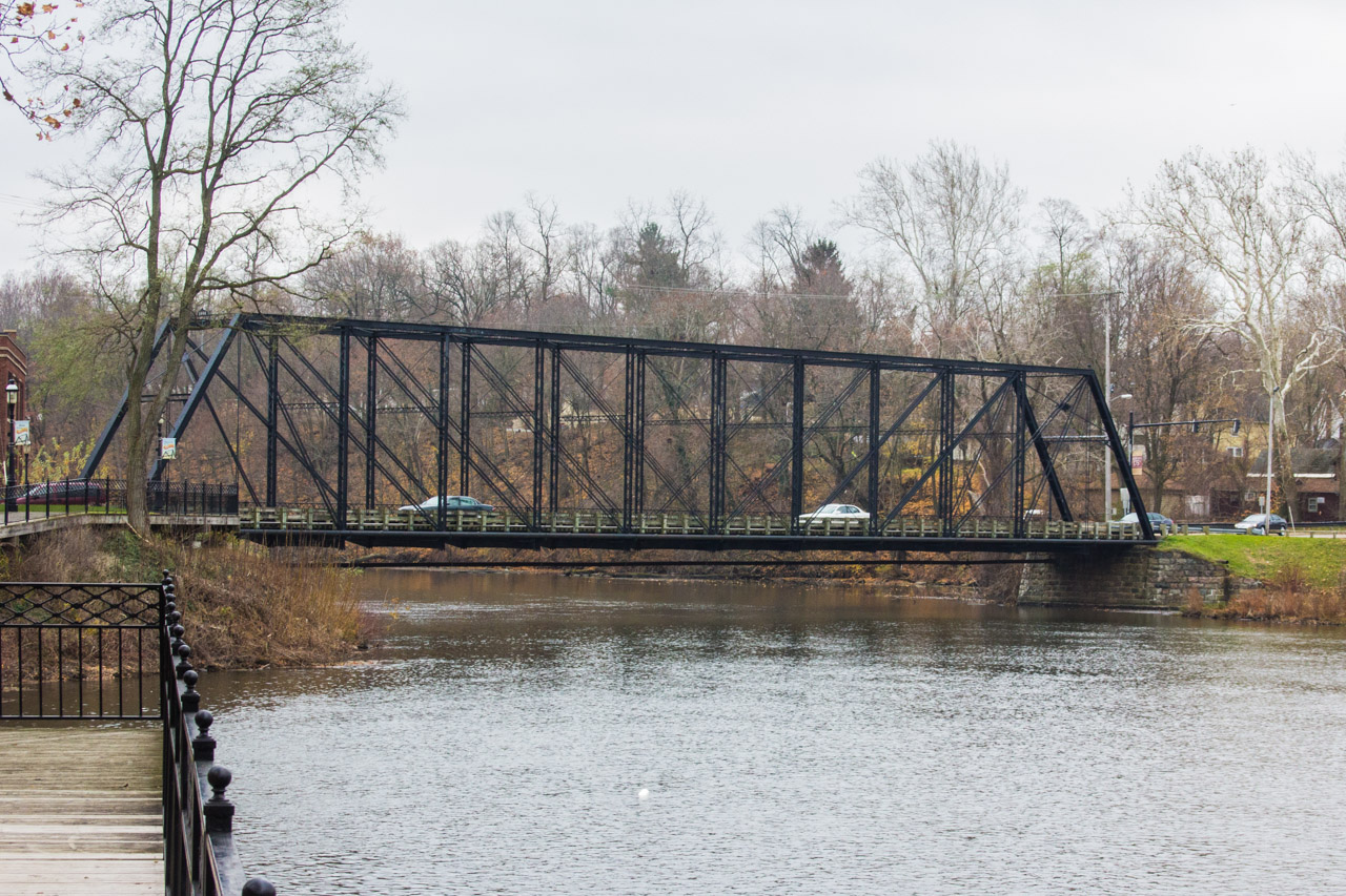
The Second Street Bridge in Allegan — the Gun River Bridge Historic Site — where the Gun River passes through the county seat. Photo: rossograph via Wikimedia Commons (CC BY-SA 3.0).
The Gun River is a small stream in Allegan County in southwest Michigan — and one of the quiet mysteries of this guide. We could verify no established paddling route, no documented public access, and no reliable mileage for it. What we can document is its history: the Second Street Bridge in Allegan is listed as the Gun River Bridge Historic Site, marking where the river passes through the county seat.
Small streams in this part of Michigan are typically narrow, winding, and intimate — the kind of water more often explored by anglers than kayakers. Without verified access or route information, though, we can’t responsibly describe a trip here.
If you live nearby and want to investigate, do it as a scouting project: check county plat maps for public road crossings, view the river from the historic bridge site in Allegan, and ask local anglers or the county road commission about legal access. Then tell the club what you find — this guide gets better when paddlers share ground truth.
Allegan County itself is well worth a paddler’s attention — the county seat sits amid a network of small streams, lakes, and wetlands. But countywide promise doesn’t make any particular stream paddleable, and the Gun River’s specifics remain unverified: we don’t know its typical depth, its obstructions, or where — if anywhere — the public can legally reach it. Until a paddler scouts it and reports back, this page stays honest about what isn’t known.
At a Glance
- Approximate length: Not documented
- Difficulty: Not established
- Water character: Small southwest Michigan stream (details unverified)
- Best season: Unknown
Paddling Sections
No documented paddling sections. No put-in, takeout, or mileage on the Gun River could be verified from public sources. The map pin marks the Second Street Bridge area in Allegan — the Gun River Bridge Historic Site — as a geographic reference only, not a launch.
How to help document it: Start at the Second Street Bridge historic site in Allegan to see the river’s character. Check the Allegan County plat book or GIS parcel viewer for public road crossings, look for public land along its course, and ask at local bait shops what anglers know. Report verified public access — with photos and coordinates — to the club so this guide can grow.
Hazards & Portages
- Information gap: Dams, logjams, fences, and water levels are all unverified — scout from shore first.
- Private land: Small streams here flow mostly through private property. Never trespass to reach the water.
Access & Parking
None documented. No public launch on the Gun River could be verified. The historic bridge site in Allegan is a landmark for viewing the river, not a confirmed put-in.
Map
The pin marks the Second Street Bridge area in Allegan — the Gun River Bridge Historic Site — as a geographic reference only, not a launch.
Paddle It With the Club
Mystery streams are how local knowledge gets built — carefully, and shared. Join the West Michigan Kayaking Club to scout responsibly and report back with the club.
Michigan’s Lower Peninsula River Guide • Join the West Michigan Kayaking Club on Facebook