Yellow Dog River Kayaking Guide
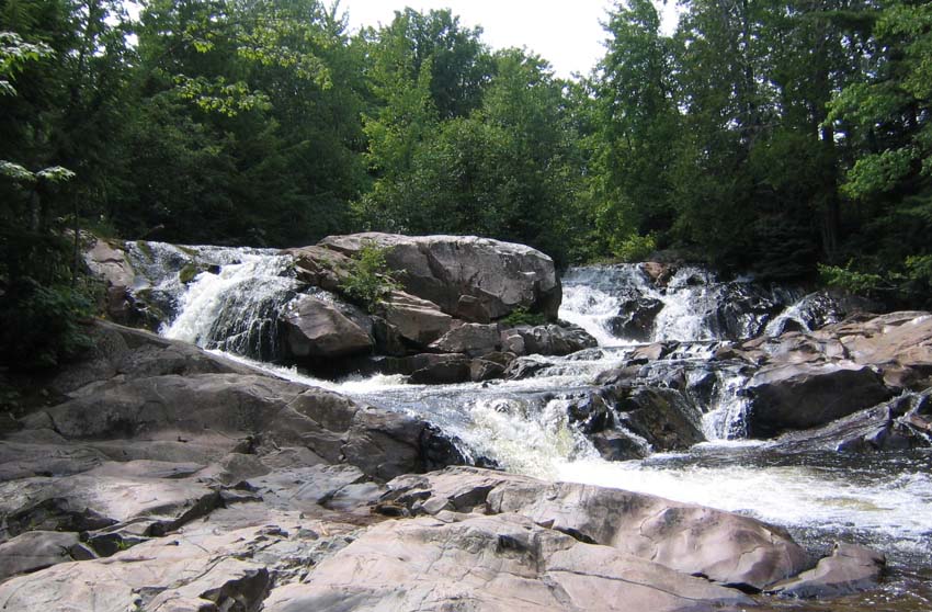
The Yellow Dog River is one of the wildest rivers in Michigan's central Upper Peninsula — roughly 28 miles of river falling from the McCormick Wilderness area to Lake Independence, dropping about 1,108 feet along the way. The watershed spans northwestern Marquette County into eastern Baraga County. Those numbers tell the story before any description does: this is a steep, powerful river, and its multiple falls and rapids make it inappropriate to present as a continuous recreational paddling route.
Yellow Dog Falls, pictured above, is the river's signature feature — and the reason this guide draws a firm line. Falls of this scale in a wilderness river are not obstacles to portage around on a casual trip; they are the defining character of a river that belongs to expert whitewater paddlers or to no paddlers at all. The Yellow Dog's gradient, remoteness, and lack of documented access combine into a simple verdict: admire it, do not plan a through-trip on it.
What the Yellow Dog offers the paddling community is context and inspiration. Its watershed is among the most intact in the Upper Peninsula — the kind of country that reminds you why wild rivers matter. Paddle the region's documented rivers, support the conservation of wild watersheds like this one, and visit the Yellow Dog's falls on foot, where they can be appreciated without anyone getting hurt.
Yellow Dog River at a Glance
- Region: Central Upper Peninsula — Marquette and Baraga counties, McCormick Wilderness to Lake Independence
- Difficulty: Expert-only at most — multiple falls and rapids; no continuous recreational route
- Character: About 28 miles; roughly 1,108 feet of drop; wild, remote, and powerful
- Key feature: Yellow Dog Falls and additional falls/rapids throughout
- Watch for: Falls, steep gradient, extreme remoteness, no documented access
Paddling the Yellow Dog River
We do not describe a paddling route for the Yellow Dog River, because no continuous recreational route should be implied. A river dropping over a thousand feet in 28 miles through wilderness, with multiple falls and rapids, is not a trip — it is a series of hazards connected by short pools. Even expert whitewater paddlers would treat this river as a collection of individual, scouted drops rather than a float.
The river's mouth at Lake Independence (near 46.80536, -87.70132) is the most accessible reference point, and the lake itself offers flatwater paddling in a scenic setting. But the river above the lake is a different world: roadless, rugged, and unforgiving. The McCormick Wilderness at the headwaters is protected precisely because it is untamed — visit it on its own terms, on foot.
Hazards & Portages
Multiple falls and rapids are the headline hazards, compounded by extreme remoteness, no documented access points, and a watershed where rescue would be slow and difficult. This is not a river for intermediate paddlers, casual groups, or anyone without expedition-level skills and planning. The safe way to experience the Yellow Dog is from its trails and overlooks.
Access & Parking
No public boat launch for the Yellow Dog River was found in our research. The mouth area near Lake Independence (46.80536, -87.70132) is a geographic reference, not a put-in. Access to the watershed is extremely limited — consult the Michigan DNR and local land managers before considering any visit, and do not attempt a river trip here without expert skills and a full expedition plan.
Map
Map centered near the river's mouth at Lake Independence (46.80536, -87.70132), shown for reference. No verified public launch exists.
Paddle It With the Club
The West Michigan Kayaking Club paddles rivers like the Yellow Dog River all season long. Come float with us!

