Trip Report | Published November 4, 2026
Thornapple River: Nashville to Thornapple Lake
A fast, friendly paddle with good current, a four-tier rock drop and no portages.
It was a great day to be on the Thornapple again. This was going to be the last Thornapple paddle for Tim Postma and me as far east as possible, but after some river intel it turned into an easy 8.6 miles in just three hours, from the Riverside Park boat launch in Nashville to the Thornapple Lake boat launch. The current was pretty good, there were no portages, and we only stopped once for lunch and to let me dry off.
The Paddle
1. Launching at Riverside Park in Nashville
We put in at the Riverside Park boat launch in Nashville and were on moving water right away. Good current set the pace for the whole day.

2. The four-tier rock drop
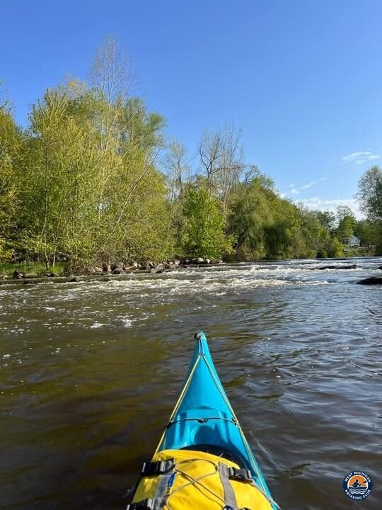
Near the start we came to a four-tier rock drop that appears to be a dam removal feature. It was a fun early test and set the tone for a lively paddle.
3. Lunch and a quick dry-off
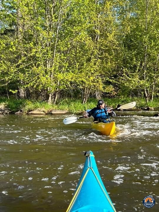
We only stopped once, for lunch and to give me a chance to dry off. I decided to grab a branch hanging in the middle of the river, and it flipped me right in. Oops! Tim had a good laugh, and so did I.
4. Easy miles to Thornapple Lake
With no portages and plenty of current, the miles went quickly. We finished at the Thornapple Lake boat launch after 8.6 miles and about three hours on the water.
USGS Flow
Recorded flow, May 10, 2025: 474 cfs daily mean discharge at USGS 04117500, Thornapple River near Hastings. Gage height: [not available] — USGS publishes no daily gage-height values for this gage.
This report uses USGS gage 04117500, Thornapple River near Hastings, just downstream of the Thornapple Lake takeout. Only recorded USGS values are used here.
USGS 04117500, Thornapple River near Hastings (daily values)
Historical Weather
Recorded high: 66°F
Recorded low: 32°F
Recorded precipitation: 0.00 inches, no rain or snow
Source: NOAA records for the Hastings, Michigan station, as compiled by Extreme Weather Watch. Recorded observations only.
Technical Trip Information
| Date | May 10, 2025 |
|---|---|
| River | Thornapple River, Barry County, Michigan |
| Launch | Riverside Park boat launch, Nashville GPS: 42.6083, -85.0917 (approximate) |
| Takeout | Thornapple Lake boat launch, Nashville GPS: 42.6256, -85.1790 |
| Distance | 8.6 miles |
| Time on water | 3 hours, one lunch stop |
| Current | Pretty good |
| Obstacles | No portages, one four-tier rock drop near the start, a hanging branch in mid-river |
| Water classification | Class I (American Whitewater scale) |
| Paddlers | Tim Postma and Brad De Young |
Launch coordinates are the Nashville Dam location from the National Inventory of Dams, used as an approximation for Riverside Park. Takeout coordinates are from the Michigan DNR access site listing. Confirm the exact parking and launch spots on a map before you go.
Safety
- Scout drops like the four-tier rock drop before running them, and choose your line first.
- Do not grab branches or overhanging wood in moving water. It can flip you quickly.
- Wear your life jacket for the entire trip and carry a throw rope, whistle and a change of dry clothes.
- Check current USGS flow before you go. Good current means less time to react.
More Than the Miles
This paddle was a reminder that a little river intel can turn a plan into something better. Good current, good company and a good laugh made it a day to remember.
- 8.6 miles from Nashville to the Thornapple Lake boat launch
- 3 hours on the water with one lunch stop
- A four-tier rock drop and zero portages
- One surprise swim after grabbing a branch
Thank you to Tim Postma for another great day on the Thornapple.
More Than Just a Kayaking Club
West Michigan Kayaking Club is a community of active paddlers who share rivers, challenges and good stories. Membership and participation are 100% free.
Wild Rivers. Rugged Trails. Real Adventure.